This version updates the EPSG viewer to add in a Flow Chart showing the configuration of the Coordinate Reference Systems and Coordinate Operations.
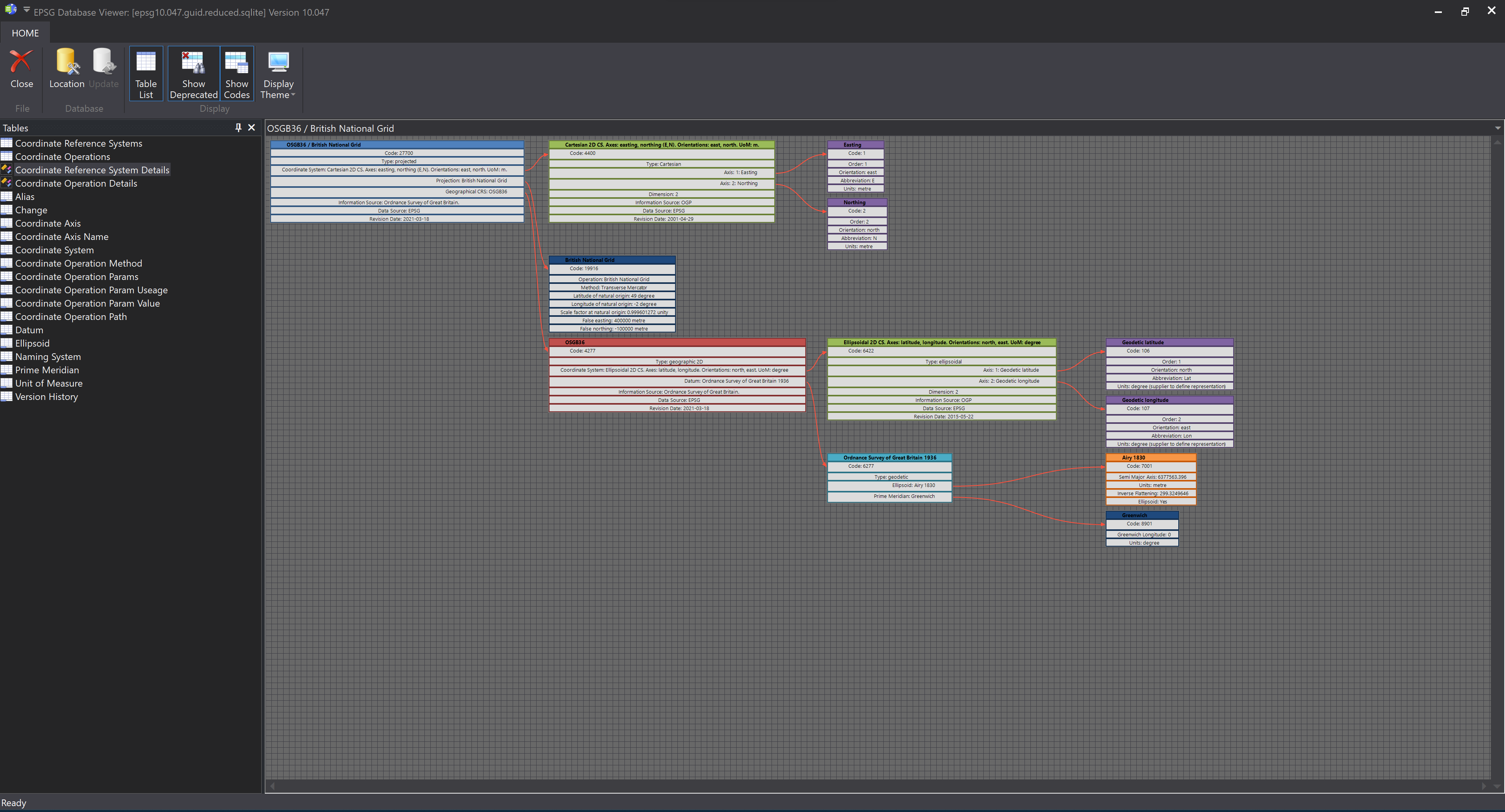
This version updates the EPSG viewer to add in a Flow Chart showing the configuration of the Coordinate Reference Systems and Coordinate Operations.
This version updates the calculator to use the latest version of our internal geodetic library, which uses the new v10 ESPG dataset.
The calculator is now split – there is a simple calculator which only performs conversion using 2D Geographic (Lat/Lon) and 2D Grid (East/North) points. The Advanced Calculator can be used to perform other conversions (e.g. using Geocentric positions)
This version updates the software to handle high-DPI displays. There is also an update to the latest version of the EPSG Database
Geodetic Calculator for Apple iOS devices has been given a long-overdue update to bring it into line with the Windows version of the calculator (available as from the download page).

This version also updates the core EPSG Database used within the app to the latest version (8.9) show less
This version updates the EPSG viewer to allow Coordinate Reference Systems and Coordinate Operations to be viewed using a double-click on the table.
This version adds a EPSG Database viewer to the geodetic calculator application. This viewer allows the contents of the EPSG database to be investigated
